
Master Degree in Geodetic and Cartography Engineering
 Master in Geodesy Engineering and Cartography is a specialized master that complete the studies of the Geomatic Bachelor Degree and open the possibility to have a depth knowledge and applied in Geomatics to other engineering studies
As a master of specialization, mathematical and computer specific basis for the development of the master activities have been carefully selected.
Its modular structure allows two alternative directions: the professional program, aimed at direction and project management in different fields of Geomatics and the research program aimed to research work that will culminate in the doctoral thesis in the Ph.D. program associated. For this propose, there are offered an insight study of methodologies, strategies and resources in geomatic research fields and a hard direction management preparation, available software and geomarketing, respectively.
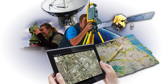
- In specialty A, the potential and perspectives of new geodesic, photogrammetric, topographic and remote sensing tools and their applications in specific fields as Global Navigation Satellite System (GNSS), RADAR, LIDAR, laser scanner and their applications to Geodynamic, earth's surface sciences, Hydrography, strains in civil engineering, agricultural work, Geodesy and Photogrammetry or metrological control of the equipment are considered.
- Specialty B deals with the geographical information from different perspectives: how it is produced in a distributed and even participative realm, how it is analyzed, quality controlled, normalized, how it is legally defined, how to display and how to consider its usability, geospatial solutions on the Internet and distributed applications. In addition, its specialized development in various fields, such as the environment, aeronautics, geomorphology and others characteristic realms of GIS are analyzed.
- In specialty C Geomatics is considered into three perspectives: the crucial component of Geomatics in the spatial planning with economic and social implications, planning, legal-administrative, geological cartography and its applications in specific rural and urban areas, coastal areas and areas that require cooperation development; environmental engineering, natural risk management and dangerousness and seismic risk and cadastre, valuations and property registration.
|
Area: Engineering and Architecture Art.5 Admission regulations:
Future Student Information:
|
- Curriculum Specialization A
- Curriculum Specialization B
- Subjects Master GCE. Especialidad A. Adquisición y Tratamiento de Datos Geomáticos
- Subjects Master GCE. Especialidad B. Gestión y Difusión de la Geoinformación
- Structure
- Master IGC Incoming Student Information (Spanish)
- Academic Organization (Spanish)
- Teaching and Research Staff (Spanish)